


Massive 8.8‑Magnitude Earthquake & Tsunami Impacts: Latest Pacific Update
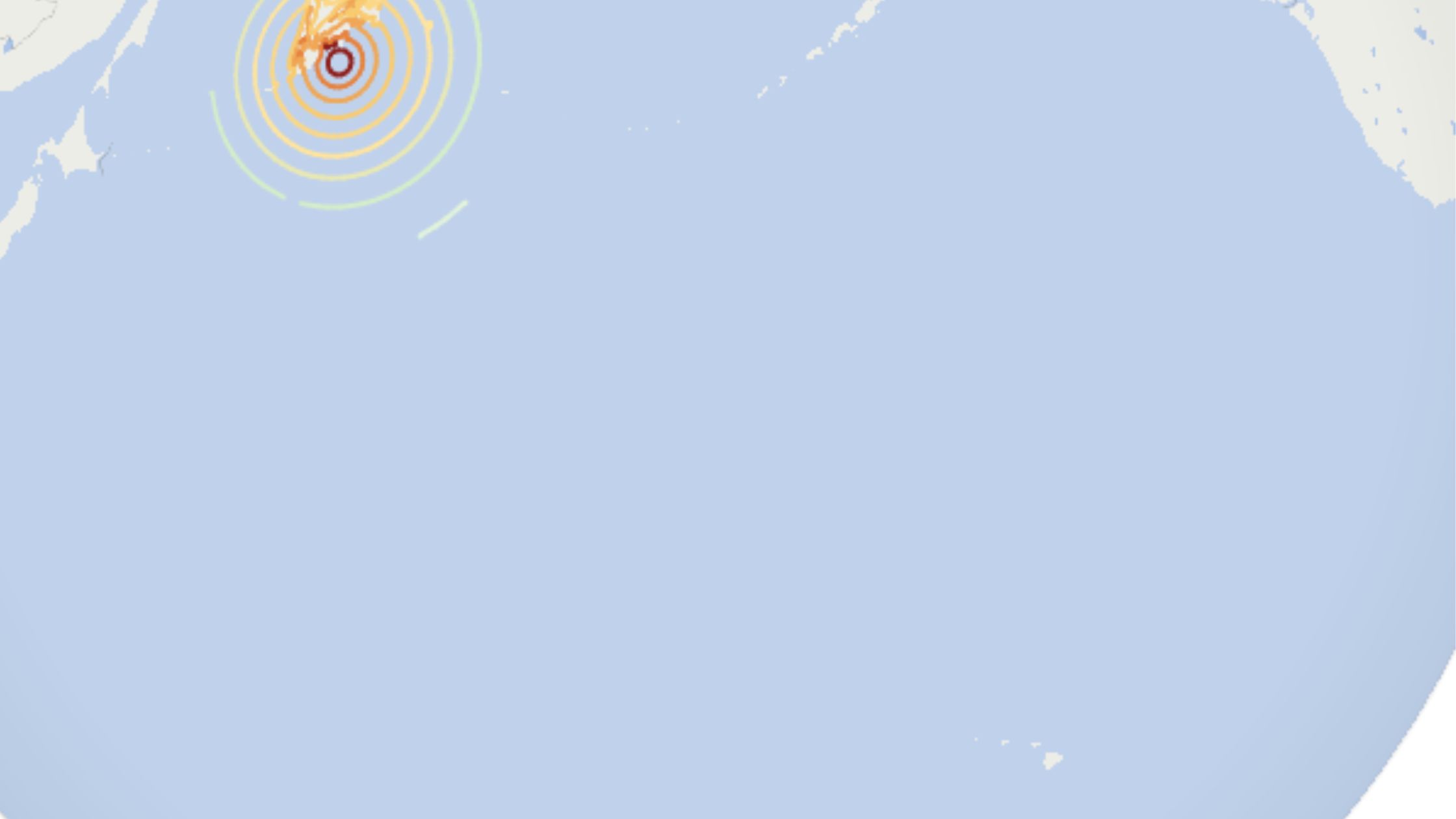
An 8.8 quake near Kamchatka triggered tsunami alerts across the Pacific. Warnings downgraded in Hawaii. Read the latest insights, stats & safety info.Massive 8.8‑Magnitude Earthquake & Tsunami Impacts: Latest Pacific Update A tsunami warning issued after a magnitude 8.8 earthquake near Russia’s Kamchatka Peninsula sparked evacuations across Hawaii, California, Alaska and Japan. First waves reached Hawaii around 7:17 p.m. local time, and officials downgraded the alert to an advisory by 10:40 p.m. (HST). This blog post dives deeply into what happened, shares real data and expert quotes, and explains how to stay informed and safe.
What Happened? Earthquake & Tsunami Timeline
- At ~1:25 p.m. HST: Earthquake struck off Kamchatka—initially measured at 8.0, later upgraded to 8.7, then to 8.8 by USGS (India Today).
- At 2:43 p.m. HST: Pacific Tsunami Warning Center issued tsunami warnings for Hawaii (www.ndtv.com).
- At 3:23 p.m.: Warning sirens activated across Hawaii, recurring at intervals to alert residents (The Washington Post, The Week).
- Around 7:17 p.m.: First wave hit Hawaii, and water began receding in places like Hanalei Bay and Haleiwa on Oahu’s North Shore. Governors warned of multi‑wave danger (The Washington Post).
- Around 7:30 p.m.: PTWC director noted water levels dropping below sea level, but cautioned that the threat remained ongoing (The Washington Post).
- About 10:40 p.m.: Warning downgraded to advisory after wave heights stabilized below three feet; evacuations lifted shortly thereafter (The Week).
Impact Across the Pacific
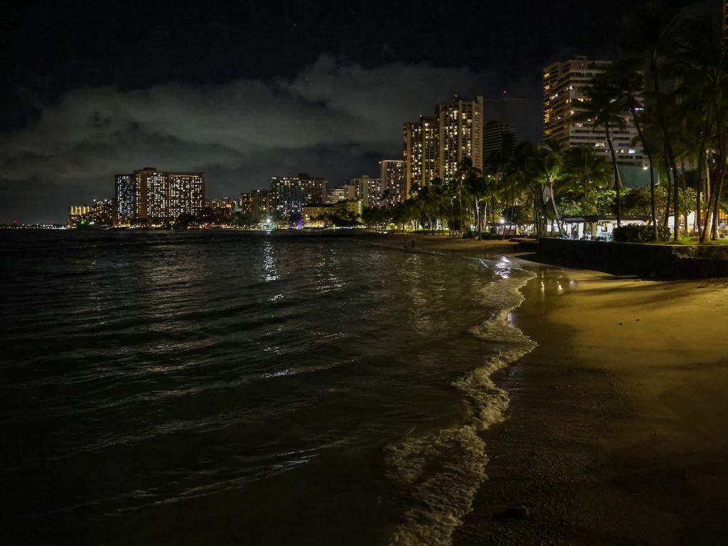
Hawaii
- Peak tsunami wave reached 5.7 ft (≈1.7 m) above normal at Kahului, Maui; other spots saw up to 4.9 ft (The Wall Street Journal).
- Traffic bottlenecks and vertical evacuations occurred. Notably, Oprah Winfrey opened her private road on Maui to assist coastal residents evacuating inland (People.com).
- No major damage or deaths reported; emphasis remains on strong currents and possible residual hazards even after advisory downgrade (The Washington Post).
U.S. West Coast (California, Oregon, Washington, Alaska)
- Northern California: Crescent City recorded waves up to 3.5 ft, Port San Luis had rapid and damaging tidal surges; Monterey Bay saw tidal swings of ~2 ft (The Wall Street Journal).
- Oregon & Washington: Minor wave activity (1–2 ft), but warnings remained due to dangerous currents in harbors and beaches (The Week, Asharq Al-Awsat).
- Alaska: Advisory extended along Aleutian Islands and Alaska Peninsula; observed waves under 30 cm in some communities (Sky News).
Japan & Russia
- Japan: Nearly 2 million people evacuated, anticipating waves up to 3 m (≈10 ft). Highest observed was ~40 cm (≅16 inches) in Hokkaido and Iwate ports (Sky News).
- Russia’s Far East (Kamchatka, Kurils): Waves up to 4 m struck Severo‑Kurilsk, prompting evacuations. Regional governor emphasized strong but limited damage early on; some minor injuries and building damage recorded (Sky News).
- Aftershocks up to 7.5 magnitude expected for weeks to come (Sky News).

Why This Earthquake Matters
- This quake ranks among the six strongest ever recorded, comparable to the 2011 Tohoku (Japan) quake and the 1952 Severo‑Kurilsk quake (~9.0) (The Washington Post).
- Its shallow depth (~19–20 km) amplified sea‑floor displacement and tsunami risk (The Washington Post).
- It occurred in the Kamchatka–Kuril subduction zone, a notorious hotspot for megathrust earthquakes (Wikipedia).
- Scientists warn that foreshocks like the July 20 quake (7.4 M) could offer clues for future forecasting—though earthquake prediction remains highly uncertain (The Washington Post).
Safety Tips & What You Should Do
If You’re in a Tsunami Evacuation Zone
- Move immediately to higher ground or vertical evacuation (upper floor of tall building).
- Avoid beaches, harbors, marinas, and river mouths—dangerous currents may persist hours after main waves (indiatimes.com, Asharq Al-Awsat).
- Listen to local officials before returning home—even after warning is downgraded.
Stay Informed
- Track alerts from Pacific Tsunami Warning Center and National Weather Service.
- Use interactive evacuation maps to determine if you’re in a zone (e.g. Hawaii EMA zone map).
- Monitor aftershocks, which may trigger additional waves.
Prepare in Advance
- Build an emergency kit (water, food, flashlight, radio).
- Develop a plan for vertical and horizontal evacuation routes.
- Practice earthquake drills—drop, cover, and hold on.
Key Numbers & Trustworthy Quotes
- Magnitude 8.8, shaking 19 km below the seabed; categorized as one of the top six strongest earthquakes ever recorded (indiatimes.com, TIME).
- Wave peaks: Maui 5.7 ft, Crescent City 3.5 ft, Kamchatka 4 m.
- “Destructive tsunami waves expected”, warned Hawaii officials on X social media (Sky News).
A timeline chart from 1:25 p.m. HST quake to 10:40 p.m. advisory downgrade, showing wave arrival times at Hawaii, California, Japan, and Russia. Include wave heights, evacuation zones visually, and a map of Pacific tsunami spread zones.
The July 30, 2025 magnitude 8.8 earthquake off Kamchatka triggered tsunami alerts that reverberated across the Pacific—from Russia to Japan, Hawaii, and the U.S. West Coast. Although the worst fears didn’t materialize—thanks to rapid warning systems and public response—this event underscores the power of nature and the importance of preparedness.
What You Can Do Now:
- Stay alert for aftershock and advisory updates.
- Review your emergency and evacuation plans (including for vertical evacuation if you live in coastal zones).
- Share this information with friends or relatives living in tsunami-prone areas.
Internal Links
- For earthquake preparedness steps, see our post: “Earthquake Survival Guide: What to Know”.
- Curious about past major Pacific earthquakes? Check “Top 10 Historic Megathrust Quakes & Tsunamis”.
External Authority Links
- U.S. Geological Survey (USGS) for official earthquake magnitude and location details.
- Pacific Tsunami Warning Center (NOAA/NWS) for real‑time tsunami advisories and marine hazard info.
Stay safe, stay informed — and make sure your family is ready.